
search
Berlin bus 100 map
Bus 100 route map. Berlin bus 100 map (Germany) to print. Berlin bus 100 map (Germany) to download. Among the many ways to get a panorama of Berlin in a few hours, berlin bus 100 is the one that is economical, efficient, and can be used in all weathers: the 100 or 200 bus, whose route will give you an overview of the historic city centre of berlin (berlin bus 100 map). You can get on and off from berlin bus 100 as you please, all for 120 minutes, for the price of a simple bus ticket. There is one every 7/8 minutes.
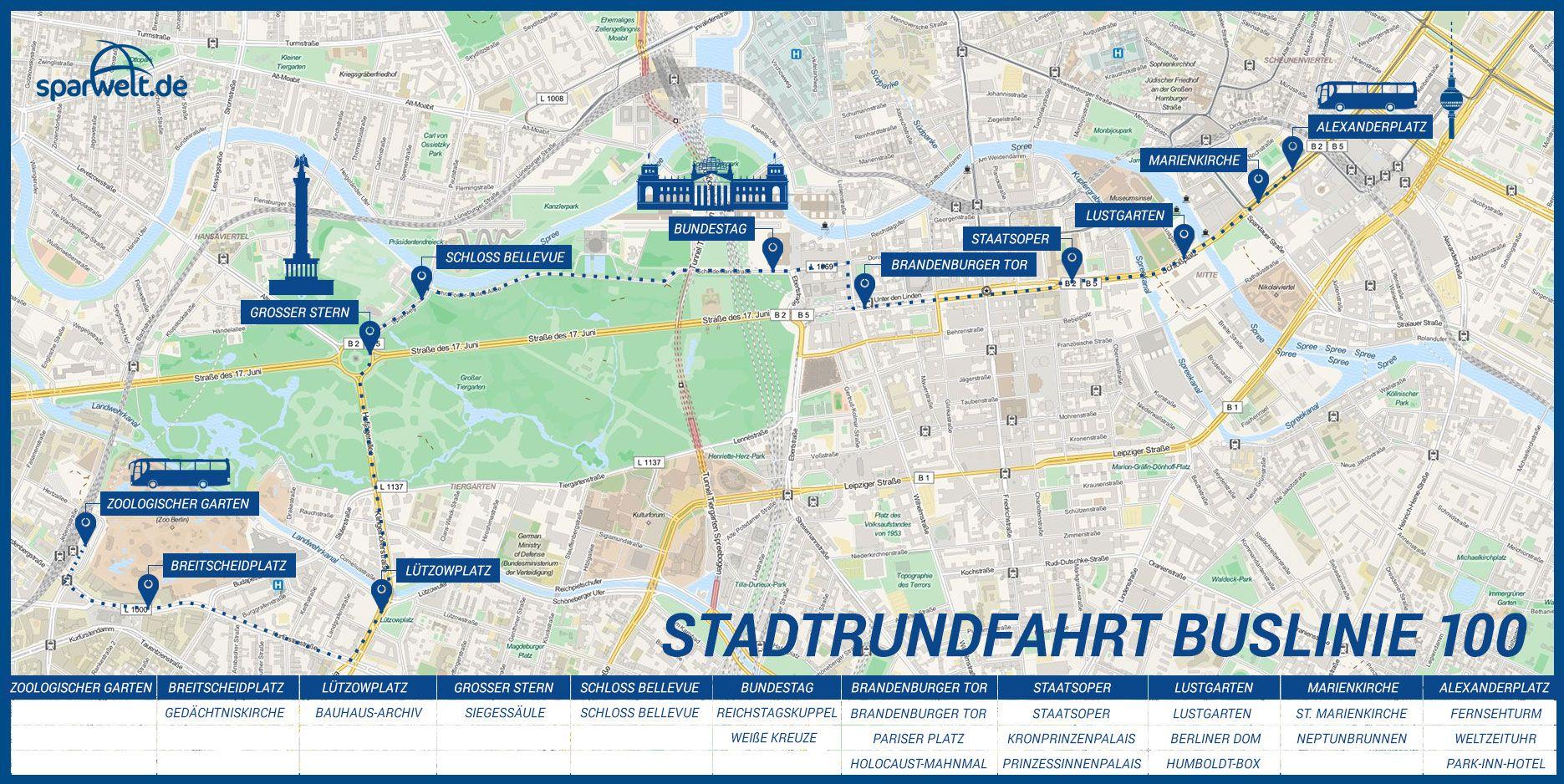
An insiders tip to explore Berlin easily and on budget is to take berlin public bus line number 100. A ride on berlin bus 100 is a "Must Do" for each tourist. The tour starts at Zoo station in the City West and ends at Alexanderplatz in the City East. The bus departs several times per hour from Zoologischer Garten station and ends at Alexanderplatz as its shown in berlin bus 100 map. Bus stops are numerous, so you will get a good overview of Berlin central district "Mitte".
The berlin bus 100 (Direction: S+U Alexanderplatz Bhf/Memhardstr as you can see in berlin bus 100 map ) has 19 stops departing from Hertzallee and ending in S+U Alexanderplatz Bhf/Memhardstr. Berlin bus 100 time schedule overview for the upcoming week: Starts operating at 12:08 AM and ends at 11:48 PM. Operating days this week: everyday.