
search
Berlin metro map
Map metro berlin. Berlin metro map (Germany) to print. Berlin metro map (Germany) to download. The Berlin Underground (U-Bahn) or berlin metro began its construction in 1902 and has a long history. During the First and Second World Wars, berlin metro construction had to be suspended and the facilities suffered extensive damage which was subsequently rectified. Later, when the city was divided, the metro network was also divided, leaving a few "ghost" stations in the intermediate zone between East and West Berlin (as its shown in the berlin metro map).
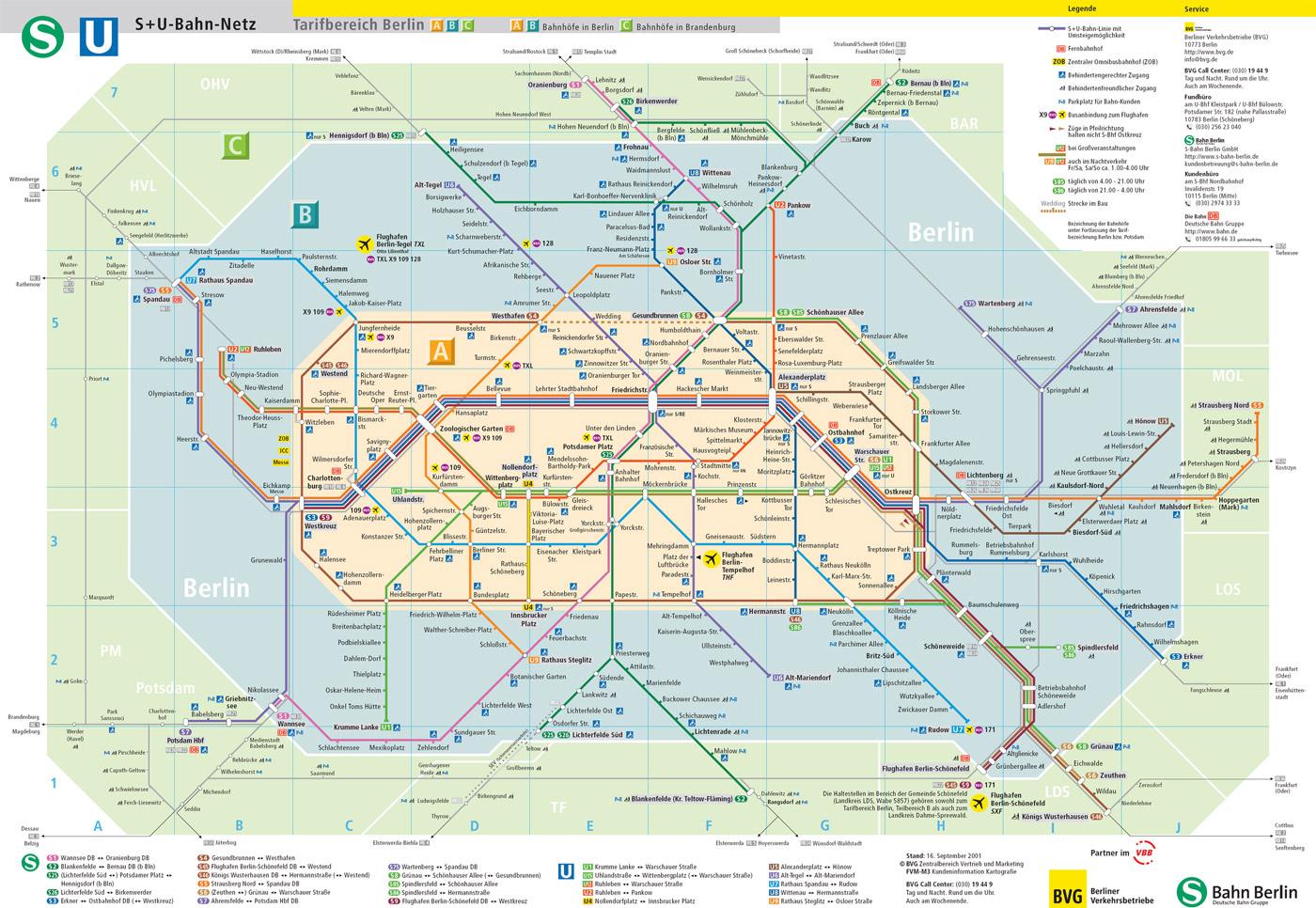
The berlin metro is run by the Berliner Verkehrsbetriebe (BVG). The metro network of berlin today comprises 147 kilometres of track spread over 10 lines and 173 stations. Most of the 10 lines are underground, but some are overhead. The direction to take is indicated by the name of the last station in either direction. Inside the metro, you will find maps of the network and line details with all connections. Large maps are also displayed on the platforms of the berlin stations.
Berlin metro tickets are valid on the S-Bahn (S-Bahn), buses and trams (berlin metro map). Tickets can be purchased from ticket machines on the platforms or at the ticket counters at the main berlin stations. During the week, most metro lines run between approximately 4 a.m. and 1 a.m. the next day. During rush hours, trains run every 5 minutes, in the evening every 10 minutes. During the week, buses replace the berlin subways between about 1 a.m. and 4:30 a.m. every half hour.
Berlin S-Bahn and U-Bahn (suburban rail and underground in berlin metro map) combine very well to provide fast, daily travel in and around berlin. They operate from 4 hours to 1 hour on weekdays. There are no gates to access the platforms, but you have to compost before boarding a metro. The U-Bahn lines U1 and U2 and the S-Bahn line S7 operate all night on Friday and Saturday. Only the U4 does not operate at night. The metro line U9 is replaced by a bus at night on weekends.