search
Berlin tram map
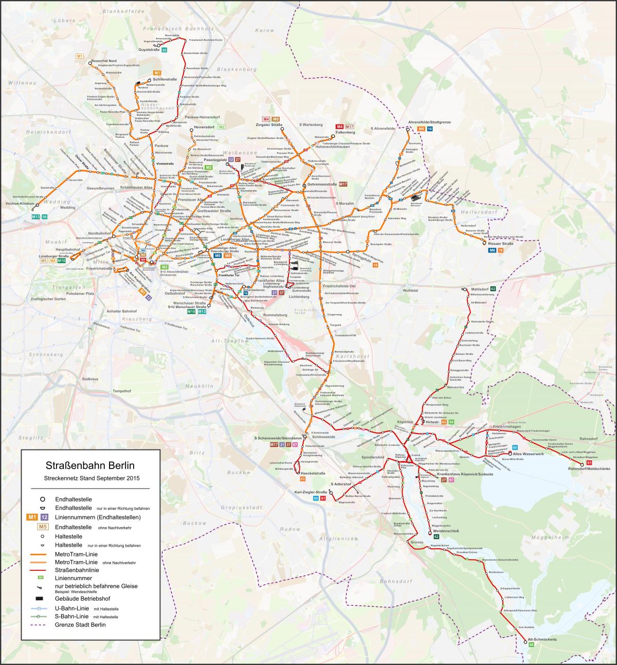
Tram map of berlin. Berlin tram map (Germany) to print. Berlin tram map (Germany) to download. Tram lines extend the route network of the U-Bahn and more than 20 tram lines run through Berlin, mainly in the eastern part of the city (see the berlin tram map). Metrotram lines run more often than the regular trams. Tram and Metrotram in Berlin are maintained by the Berliner Verkehrsbetriebe BVG and belong to the berlin Transport Association Berlin-Brandenburg VBB. Thus U-Bahn tickets are also valid for trips with buses, the S-Bahn, trams and vice versa. Ticket machines are located inside the trams but can also be purchased at ticket machines on the platforms of the S- and U-Bahn or ticket counters in larger stations.
Berlin tramways (Strassenbahn) run almost only in the eastern districts of Berlin as its shown in the berlin tram map. Those designated as M1, M2, etc. run 24 hours a day, 7 days a week. The M1 tram line of berlin, which connects Prenzlauer Berg to the Museum Island via Hackescher Markt, is very useful. Tram tickets can be bought from the ticket machines on the streetcars (cash only), they do not have to be stamped.
In 1865, the first horse-drawn tram line of berlin was put into service. The electrification of the network took place at the end of the 19th century. The division of Berlin sounded the death knell for the tram in the western sectors in 1967 (berlin tram map). Reunification led to the modernization of the infrastructure in East Berlin, with the introduction of new streetcars. A streetcar ride in East Berlin and its districts of Prenzlauer Berg is a great way to discover East Berlin and its districts.
Berlin light rail system consists of 22 lines and nearly 400 stops, making it one of the longest in the world. The tram was the most developed and most used means of transportation in East Berlin during the Cold War. It is interesting to go to the end of the M10 streetcar line at the Warschauer station Straβe as you can see in the berlin tram map. This is a station very close to the old wall, where you can see graphically how the division of berlin has affected the development of public transport. Near the station you can see the longest remaining portion of the Berlin Wall, East Side Gallery.


