search
Tegel airport map
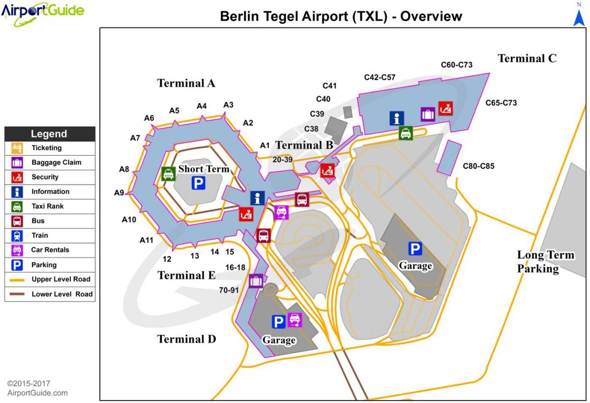
Berlin tegel airport map. Tegel airport map (Germany) to print. Tegel airport map (Germany) to download. Berlin tegel airport (TXL), also known Otto Lilienthal Airport is the main international airport serving the capital of Germany (see the tegel airport map), however tegel airport comes only as the fourth busiest airport in Germany with more than 20 million passengers annually. It is also one of two airports in Berlin, the second being Berlin Schönefeld which mostly handles flights of low-cost carriers.
Tegel airport is located in Berlin northern district Reinickendorf and is closer to the city than the airport in Schönefeld (as its shown in tegel airport map). Once construction work at the new Berlin Brandenburg Airport Willy Brandt BER is finished, flight operations from and to Berlin will gradually move to BER and tegel Airport will be closed. Tegel Airport has no direct link to the S- or U-Bahn. The fastest way to get to the city is either by TXL Express Bus or by the Express Bus X9. Both stop right outside the terminal.
Located eight kilometers from the center of Berlin (see the tegel airport map), tegel airport map (TXL) is the city main airport. With the expansion of Schönefeld Airport. Planned for 2020, Tegel Airport is likely to close down permanently. One of the reasons for its closure is its proximity to the city center. This is an advantage for travelers, but it is actually a problem for the residents, who are forced to put up with continuous aircraft noise.


