
search
Schoenefeld airport map
Berlin schoenefeld airport map. Schoenefeld airport map (Germany) to print. Schoenefeld airport map (Germany) to download. Berlin schoenefeld airport (SXF) is located 24 kilometers southeast of Berlin (as its shown in schoenefeld airport map). At the time of the Berlin Wall, schoenefeld airport was the largest civil airport in the GDR and the only one serving East Berlin. Schoenefeld airport is currently undergoing expansion work to become Berlin-Brandenburg Airport with a view to taking over flights from Tegel Airport.
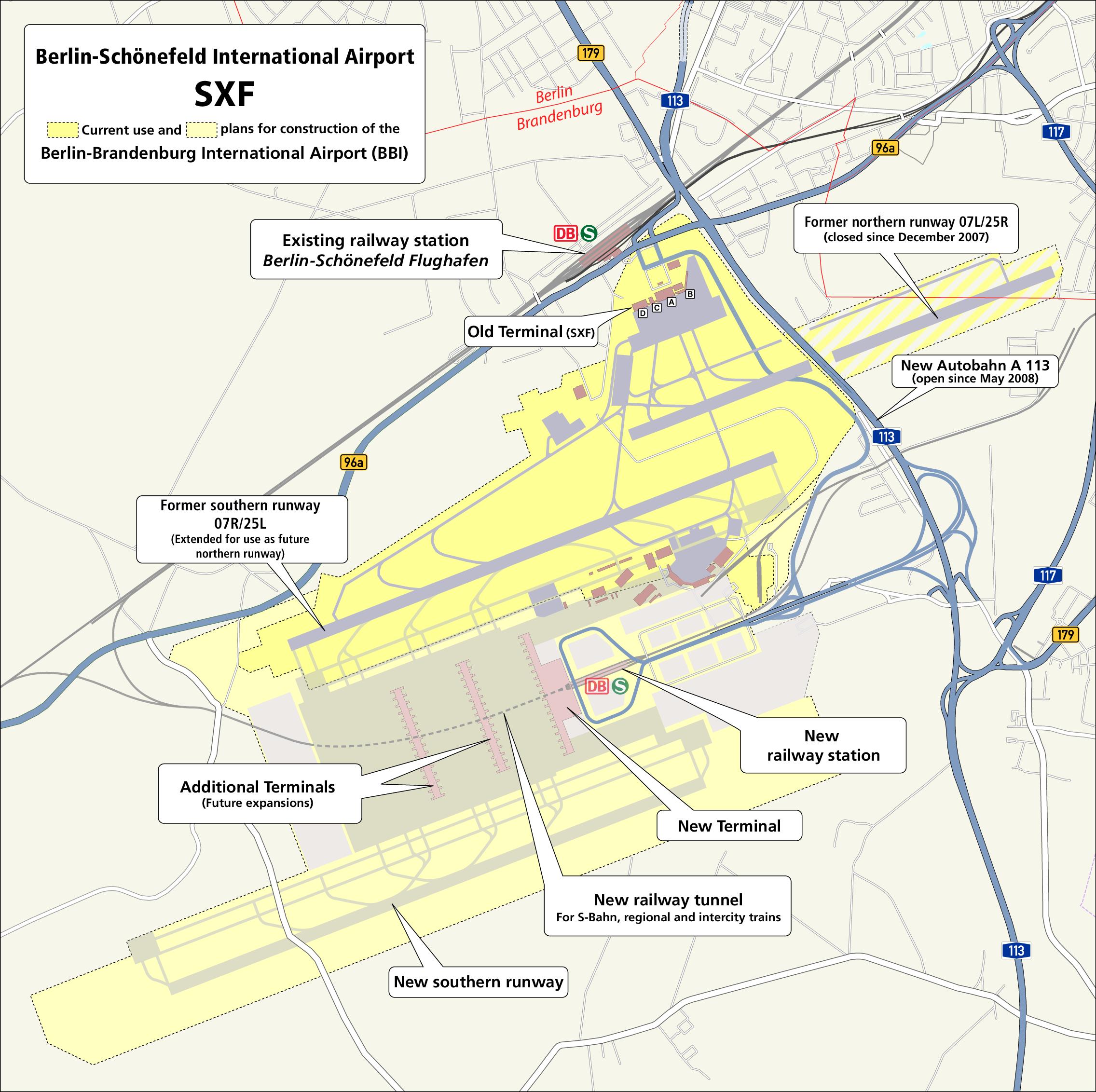
Approximately 22 km southeast of Alexanderplatz, the small airport of Schoenefeld (SXF; 030-6091 1150) is served directly by the S-Bahn and regional trains (as you can see in schoenefeld airport map). A ticket covering the ABC zones (€3.40) is required to get from schoenefeld airport to the city center. Tickets can be purchased at the station automatic ticketing machines on the platforms and in the corridors (cash and bank cards accepted; they give change). Tickets to be composted before boarding (composters on the platforms).
Schoenefeld airport can be easily reached by car via the Schoenefeld Süd exit of the A113 motorway (see the schoenefeld airport map). There is a connection to the A113 from the A100 motorway coming from Berlin city centre. The “Berliner Ring” orbital motorway A10 is connected to the A113 by the “Schönefelder Kreuz” interchange. Passengers in the schoenefeld airport entire catchment area therefore have ideal links to the airport at their disposal. From Potsdam you can reach Schönefeld via the B96a federal road.