
search
Berlin mitte map
Mitte berlin map. Berlin mitte map (Germany) to print. Berlin mitte map (Germany) to download. Mitte literally translates to "middle" and that is (basically) where it lies. This district of berlin is plopped as close to center as possible for the squiggly line mess that is a map of Berlin. Mitte is packed full of must-see sights from Brandenburger Tor to the Reichstag, Mitte is a necessary stop for anyone traveling through or to Berlin. However, it is not recommended to stay in central Mitte.
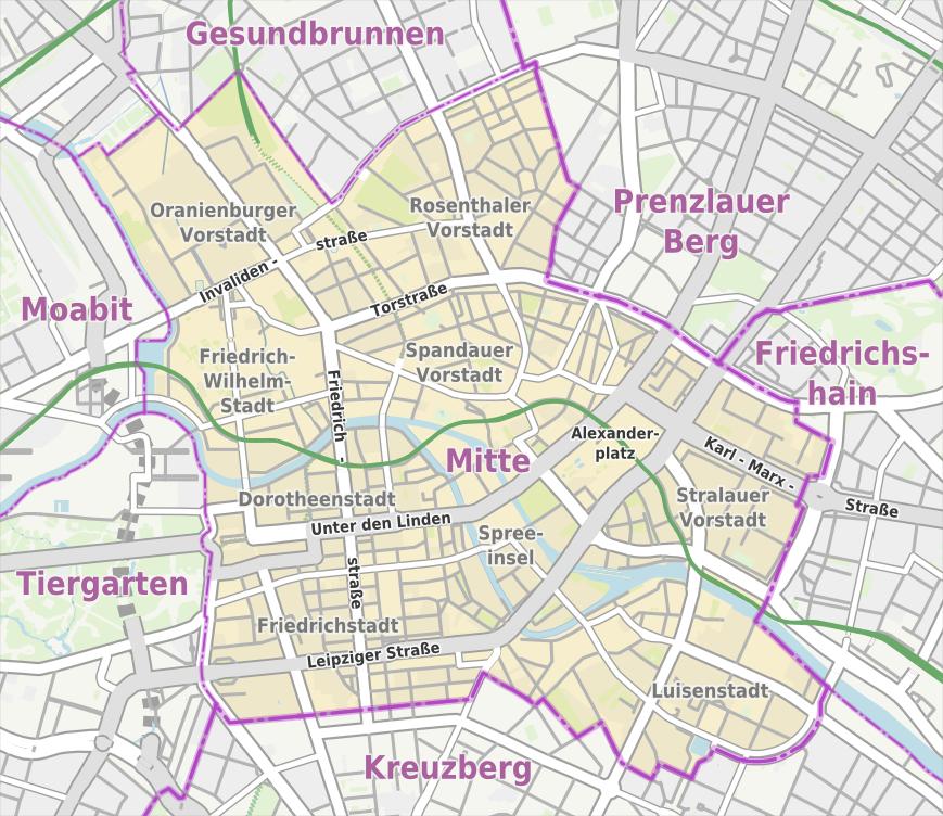
Since reunification, the old city centre of berlin, Mitte (meaning ‘middle’) has rightly snatched back the title of most-visited district from Charlottenburg. On and off the boulevard Unter den Linden are baroque and classical monuments to Prussian culture (as its shown in berlin mitte map). The architecturally humbler but more neighbourhood-like Scheunenviertel area allows the casually chic to saunter from courtyard gallery to sidewalk café. In Mitte there is only traces are left of the Jewish community that lived here from the late 17th century, welcomed by the Great Elector Friedrich Wilhelm.
The centre of Berlin, Mitte is most famous for sights like the Brandenburg Gate, Alexanderplatz, and Museum Island. The central location ( see the berlin mitte map) makes this one of berlin most expensive places to live. It is in mitte where the oldest traces of berlin can be found, and evidence of some significant transformations, as well. The gangsters that once ruled the impoverished streets between Alexanderplatz and Hackescher Markt have given way to an international crowd pursuing fashionable designer clothes, the newest food trends and frequenting the many craft shops.