
search
Breitscheidplatz berlin map
Map of breitscheidplatz berlin. Breitscheidplatz berlin map (Germany) to print. Breitscheidplatz berlin map (Germany) to download. Breitscheidplatz in berlin map is a complete complex with Kaiser Wilhelm memorial church under monument protection. In 1889 the square of breitscheidplatz berlin was laid out as "Gutenbergplatz" according to the Hobrecht plan of 1862, renamed "Auguste-Victoria-Platz" in 1892 and breitscheidplatz berlin was redesigned in 1895 after the construction of the Kaiser Wilhelm memorial church.
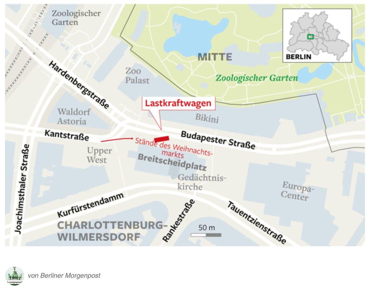
The paved square of breitscheidplatz berlin map contains some trees. In the middle of the square of breitscheidplatz berlin stands the ruins of the tower of the Kaiser Wilhelm memorial church, secured as a war memorial, flanked by the new buildings of Egon Eiermann (1959-63). The western boundary of breitscheidplatz berlin is the Schimmelpfenghaus, built between 1957-60, and the Europa-Center, built between 1963-65 in the east. In 1977/78, when the road connection between Kurfürstendamm and Budapester Strasse ("Schnalle") was abolished, a large adjoining pedestrian zone was created.
In 1982-84, the square of breitscheidplatz in berlin map was completely redesigned by Ivan Krusnik and Oskar Reith. Joachim Schmettauund created the red granite globe fountain with bronze figures. In 2005-2006, the square of breitscheidplatz berlin was redesigned, this time by the landscape architecture office Heike Langenbach / Roman Ivancsics. By closing the car tunnel along Budapester Strasse and removing the raised beds, a uniform area was created and the north side connected to the square of breitscheidplatz berlin with Budapester Strasse and the Bikinihaus.